
I'd been searching RideWithGPS.com for a suitable route near Ione. I needed to go to Plymouth to pick up some wine, and I'd always thought Ione looked like it might be a pretty plce to ride. Tricia was off to ride in the Cinderella Classic, so what the heck, I planned a 60 mile solo loop using a map I found on ridewithgps, packed my stuff and headed east.
That's about when the errors started.
2. I'd looked at so many ridewithgps loops in the area that I didn't notice this one went clockwise, unlike all the others I'd looked at. I started out and never felt like I knew where I was. I had to stop too often to check my cue sheet and eventually managed to turn left instead of right. I traveled about six miles downhill before I figured out I'd erred and needed to turn around and grunt back out.
When after about 30 miles I finally got to Plymouth, I was amazed discover I'd to arrived from the west and not the east. At least, now halfway through my ride, I realized where I was and that I wasn't traveling the direction I'd thought.
The ride from Plymouth to Fiddletown was an uphill delight, though much longer than I expected. I turned on Hale Road like the cue sheet said and eventually was sure I'd made another error. The smooth road turned to crap and eventually I got to a section that served as both a road and a creek. As I contemplated crossing, and wondered how deep it really was and if I was lost, a car — one of the few I'd seen — drove up and stopped. They assured me I was still on Hale and watched me ride across after promising to alert the authorities if they saw me swept away. The water was deep enough that my foot got soaked on my downstroke.

With a soggy sock I climbed up an extended 10%-18% grade, wondering again what I'd gotten myself into. At least it was freakin' beautiful: no cars, green fields filled with yellow flowers, stands of tulips by the road, and forests. It was a cyclists paradise.
I climbed and climbed and eventually turned downhill and descended on a wonderful road into the town of Volcano. The cue sheet faked me out for a moment, but eventually I got headed down Sutter Creek Road, the long downhill I was sure had to arrive eventually.
3. The route snaked me, rather cleverly, through some back streets in Sutter and I avoided the traffic in the town. The cue sheet slipped me onto the Griffinet Rd/Sutter Ione Highway and told me to turn left on CA 124. When I got to an unmarked intersection I turned onto what looked like a 124ish highway and rode a long way before some friendly broke-down motorcyclists informed me I was on Hwy 49 going the wrong way. I made a turn and eventually headed back to Ione on Hwy 88 which, having a very narrow shoulder and a ton of cars, is not a good route for bikes.
Eventually I made it back to my car, having turned 60 miles into 72. I think I learned:
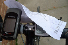
1. I need a device to hold a cue sheet.
2. Carry an actual map, and not just a cue sheet.
3. Look a bit harder at the route before I leave.
4. Take LanceOldStrong and make him navigate as he is actually good at it.
Side note: In two April days I have more road bike miles than I did all of rain-soaked March.
No comments:
Post a Comment
I'm turning off comment moderation for posts younger than 60 days, so your words will appear right quick.