Sunday, April 24, 2011

Ione loop, part two; DMD metric fail

MyLilPony rides through creek
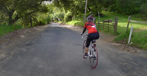
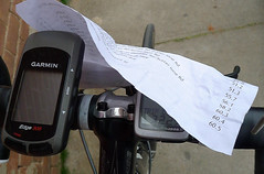
I thought my ride in Ione was so pretty I had to haul Tricia up to see it, even if it did involve riding through a creek that crosses the road. I did a better navigation job, so we didn't get lost once. I just love RideWithGPS.com for making it possible to find routes like this. And because the cue sheet is from a GPS and I'm riding with a GPS, the mileage cues are perfect!

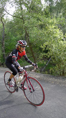
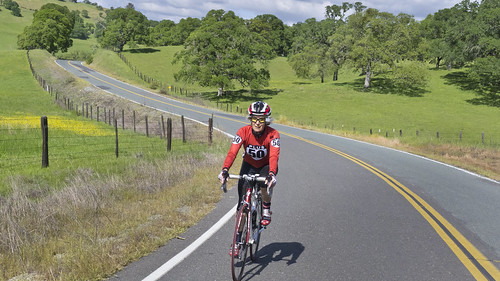
It really is a heck of a ride, and a big 'ol climb as well. The first 36 miles are all uphill with 4800 feet of climbing, increasing in steepness until the pitch hits an extended 15% with spots as high as 21. It was a grunt, but a beautiful grunt. It all pays off with a screaming decent from Daffodil Hill into Volcano on baby-butt smooth roads. From Volcano it's mostly downhill all the way home.

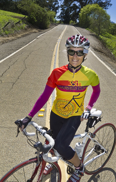
We started under cloudy skies, worried about rain, but got lucky as it stayed dry. At around mile 50 of our 60 mile trip the sun came out and the day turned perfect. We finished in wonderful light, with a delightful 5313 feet of climbing.
tricia rides near Ione

DMD Volunteer Ride Fail
Curtis is cold and tired
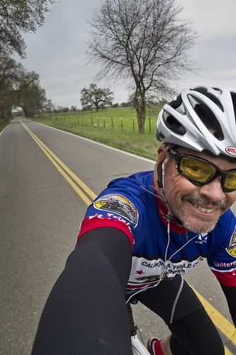
Following our Thursday adventure I played tennis on Friday, then got up at 3:30 on Saturday to ride the first 70 miles of the Devil Mountain Double as part of their Volunteer ride (I'm not riding it, but I'll be at the Mines Road rest stop handing out goodies.). I had a brake rub when I left the parking lot. Even though I fixed it quickly, the group was gone and I found myself riding alone.

I must have been beat from the last two days because I had no pop at all. The weather was cold, but I felt even colder. Even with warm clothes and full gloves I was freezing so much it hurt. I got near the Diablo Summit and said "Why am I doing this?" and headed back to the car. I still got over 4000 feet of climbing, so it wasn't a total bust. But I was sure glad to get into a car with a heater.

Monday, April 18, 2011

Diablo Century 2011

diablo century 2011 tricia
With minimal long-distance riding this year, Tricia and I were a might concerned about tackling a ride with the 100-miles and 6800 feet of climbing. We weren't really worried, just concerned. We'd been bike commuting in the rain, but that same rain had kept us pretty much away from anything over 30. We'd had one or two "real rides" but that was it.

But this ride went well. Though we both had low spots — mine climbing up toward Castro Valley  into an annoying headwind — the overall experience was reassuring. We can still ride!

The most exciting moment was after cresting Morgan Territory and descending "the plunge" — a very steep downhill that's challenging on even a normal day. We'd been in sun and nice weather. The plunge dropped us into a wet road hidden in fog. It was somewhat harrowing until we dropped out of the cloud and flew toward Livermore. Yea tailwind.

Canyon is still beautiful. Rolling into the redwoods is still like magic. And what's with car drivers in Orinda? They all drive with such a sense on entitlement, honking, backing up without looking, honking again at cars and honking at more bikes and behaving in a generally clueless manner. Do really expensive cars make you weird, or do the weird feel compelled to buy them?

Tricia, for inexplicable reasons, decided to count road kill.
Her tally: 1 squirrel, 1 bird, 3 snakes, 1 of creature undetermined species and one guy annoyingly zig-zagging up a steep section in front of her.

diablo century 2011 Tricia 2The Walnut Creek Jewish Community Center puts on a good ride. It's well marked and generally well organized. They did have a couple of flaws this year that i hope they'll correct next time around.

1. I stood way too long at check in. I'd prepaid, so it shouldn't have taken the 30 minutes it did. They really need a couple more volunteers at peak check in.

2. Last year the lunch stop at the school had us using the school restrooms. This year we were told to use the port-a-potties at the Sunol train station. When we came out we were accosted by an angry train engineer who was not happy we'd used their facilities. Apparently we could use one outside the fence, but not the ones inside. The ride organizers hadn't made that clear, and we got quite an ear full from the train people.

The Diablo Century  had a jersey this year. The photos were really ugly, but it turns out they actually did a much better job. The photo was just a mock up. I didn't get one and now I think I should have. Maybe next year.

Here's the RideWithGPS map

Wednesday, April 13, 2011

Cinderella Classic 2011

Tricia Cinderella jersey MyLilPony
I keep asking Tricia to be my guest blogger and write about the Cinderella Classic ride, the annual women-only ride put on by the Valley Spokesmen Bicycle Touring Club.
Though she got a swell new jersey, she just doesn't seem enthused about writing for this world-famous, beloved by all blog. So, I will speak for her:

She had a good time. That is all.

Sunday, April 03, 2011

Isolated in Ione, Pummeled in Plymouth, Foiled in Fiddletown

Curtis

I'd been searching RideWithGPS.com for a suitable route near Ione. I needed to go to Plymouth to pick up some wine, and I'd always thought Ione looked like it might be a pretty plce to ride. Tricia was off to ride in the Cinderella Classic, so what the heck, I planned a 60 mile solo loop using a map I found on ridewithgps, packed my stuff and headed east.

That's about when the errors started.

1. On arrival I pulled out my cue sheet and a clip then looked for a place to attach it to my bike. Whoops. My Roubaix has hidden cables, so, unlike my Kestrel, I couldn't clip it to a cable where I could see it as I rode. And my speedometer and Garmin take up a lot of handlebar space. If I'd had a clue I could have brought an elastic loop to put around the stem, but, no clue; no elastic. Having a cue sheet that wasn't easy to read would lead to more... issues.

2. I'd looked at so many ridewithgps loops in the area that I didn't notice this one went clockwise, unlike all the others I'd looked at. I started out and never felt like I knew where I was. I had to stop too often to check my cue sheet and eventually managed to turn left instead of right. I traveled about six miles downhill before I figured out I'd erred and needed to turn around and grunt back out.

When after about 30 miles I finally got to Plymouth, I was amazed discover I'd to arrived from the west and not the east. At least, now halfway through my ride, I realized where I was and that I wasn't traveling the direction I'd thought.

The ride from Plymouth to Fiddletown was an uphill delight, though much longer than I expected. I turned on Hale Road like the cue sheet said and eventually was sure I'd made another error. The smooth road turned to crap and eventually I got to a section that served as both a road and a creek. As I contemplated crossing, and wondered how deep it really was and if I was lost, a car — one of the few I'd seen — drove up and stopped. They assured me I was still on Hale and watched me ride across after promising to alert the authorities if they saw me swept away. The water was deep enough that my foot got soaked on my downstroke.

bike and rocks

With a soggy sock I climbed up an extended 10%-18% grade, wondering again what I'd gotten myself into. At least it was freakin' beautiful: no cars, green fields filled with yellow flowers, stands of tulips by the road, and forests.  It was a cyclists paradise.

I climbed and climbed and eventually turned downhill and descended on a wonderful road into the town of Volcano.  The cue sheet faked me out for a moment, but eventually I got headed down Sutter Creek Road, the long downhill I was sure had to arrive eventually.

3. The route snaked me, rather cleverly, through some back streets in Sutter and I avoided the traffic in the town. The cue sheet slipped me onto the Griffinet Rd/Sutter Ione Highway and told me to turn left on CA 124. When I got to an unmarked intersection I turned onto what looked like a 124ish highway and rode a long way before some friendly broke-down motorcyclists informed me I was on Hwy 49 going the wrong way. I made a turn and eventually headed back to Ione on Hwy 88 which, having a very narrow shoulder and a ton of cars, is not a good route for bikes.

Eventually I made it back to my car, having turned 60 miles into 72. I think I learned:
1. I need a device to hold a cue sheet.
2. Carry an actual map, and not just a cue sheet.
3. Look a bit harder at the route before I leave.
4. Take LanceOldStrong and make him navigate as he is actually good at it.

Side note: In two April days I have more road bike miles than I did all of rain-soaked March.